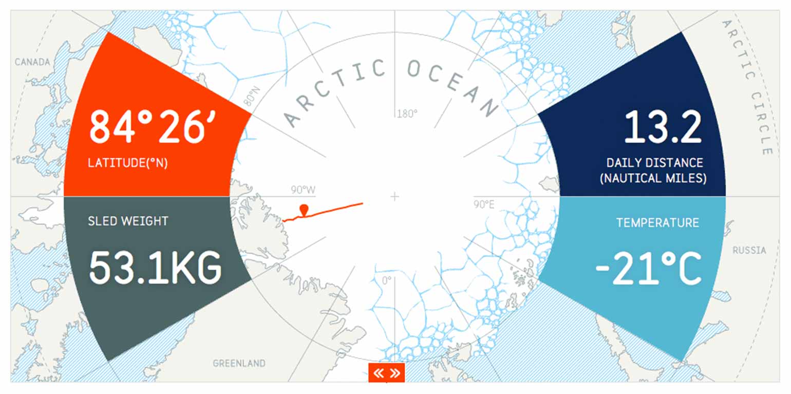
We created a custom map which took a data feed from Ben's GPS unit and updated his position in real time. His proximity to the North Pole meant basic trigonometry could be used to place him on the map.
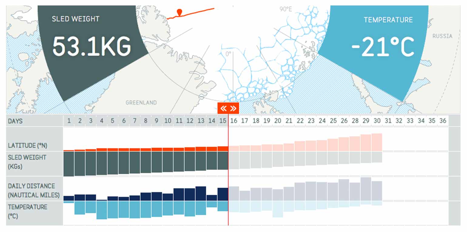
The Dashboard displayed key information so people could monitor Ben's progress. Latitude and daily distance were calculated with data from his GPS. Temperature was updated manually.
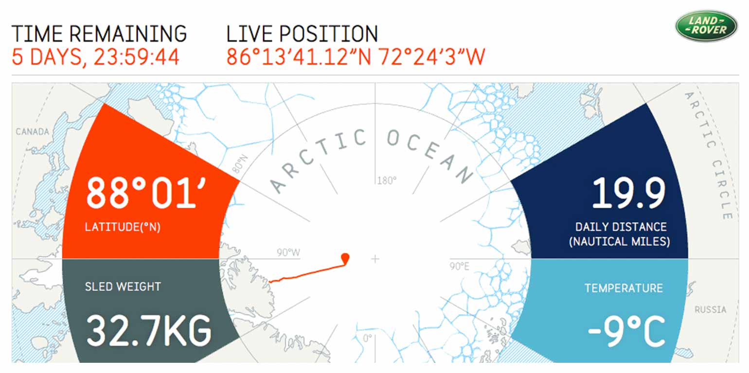
Ben needed to reach the North Pole in under 30 days to break the record. The dashboard count down and map allowed users to put the scale of the challenge into context.

Ben's position relative to the satellite his equipment communicated with meant bandwidth was extremely low. Updates of a few kb took several hours, so we created a bespoke form locally on his PDA that greatly reduced the footprint.
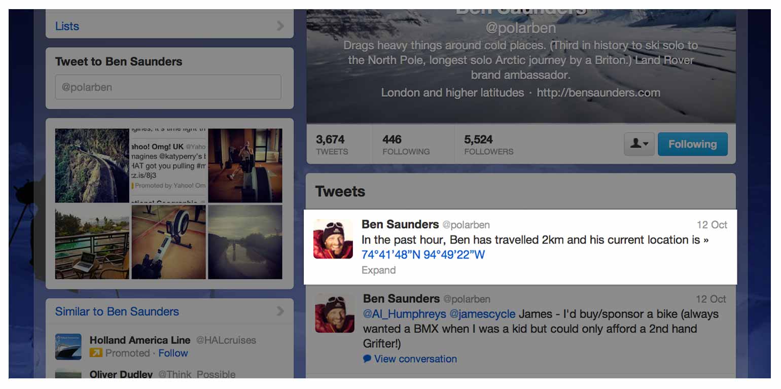
Using the data feed from his GPS and the Twitter API, automatic tweets were composed hourly. Because Ben would be on a sheet of drifting sea ice his position could change even whilst he was asleep.
Ben Saunders - North 3
Read the case studyDescription:
Website for Ben Saunders' attempt to break the speed record for reaching the north pole solo.
Client: Ben Saunders
Year: 2011
Technologies: Wordpress, Twitter API & SVG
Platforms: Web desktop


